Impact evaluation of current and future emission activities
In a great number of cases, dispersion mathematical models for the evaluation of potential impacts from emission activities are used under non idoneous criteria for the kind of orography of the terrain as well as for the meteorological calculations applied; generally based in a single point for the evaluation of wide areas. Hence, Gaussian models of simple application designed for flat territories are often used in areas with complex orography. Another crucial aspect that has to be taken into account for the obtention of representative results is the use of appropriate emission factors. Additionally, the determination of the background levels and the pollutant’s concentrations before and after the installation of the potentially emitter activities is an indispensable step. In this line, the LCMA uses mathematical numerical models applicable to different evaluation scenarios (TAPM Eulerian type - Australia, AERMOD/AUSPLUME Gaussian type - USA/Australia, CALPUFF Gaussian-Lagrangian type - USA, AUSTAL Lagrangian type – Germany,.....), plus chemical control methodologies for the characterization of the emissions.
In this field, our laboratory focuses on:
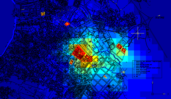
- Development of prediction impact maps (determination of maximum and minimum immission levels in several locations of the studied area) depending on the placement of the emission sources, orography and meteorology of the evaluated territory
- Study of the impact of the current activities as well as predict the impact of future activities located in the considered area
The application of the previously mentioned developments enables the generation of territorial planning tools and the design of chemical control programs focused in the optimization of realization costs
Impact maps (immission levels) of a current activity and a future activity |


Share: