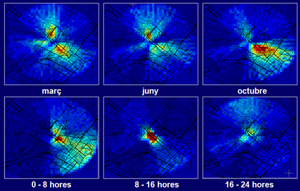
Impact of projected activities or from activities without emission control data (impact prediction maps):
The generation of impact maps requires having reliable databases of:
- Published emission factors depending on the type of activity databases
- Orographic databases
- Surface and mesoescalar (satelite data) meteorological databases
The knowledge of the maximum and minimum impact evolution through the year of a concrete activity depending on its location in the territory permits the planning of the installation of potentially emitter activities with a minimum impact in inhabited areas. Additionally, this information allows us the schedule of the sampling protocol in the minimum and maximum impact periods of the year, reducing the evaluation costs. This strategy can be both applied in the assessment of the current installed activities as well as in the determination of background levels when evaluating the possible impact of future activities.
depending on the time of the year and the hourly slot |

Share: